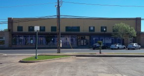
104-112 East Burke
104-112 East Burke 2016 Survey Information 2016 Survey Form 104-112 East Burke
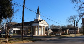
view the listing702 N. Mound
702 N. Mound The address of 702 N. Mound has become incorporated into the First Christian Church at 720-722 N. Mound, as well as at 523-25 Park St. The older building on the corner of Park and Mound was the original 1990...
view the listingLittle Hope School/Church
Little Hope 1986 Survey Information Site No.: Z-1189 Address: Approximately 6.6 miles north of Huntington Date: 1900 Description: Little Hope Church is still extant on this...
view the listingPrairie Grove Church and School #52
Prairie Grove Church and School #52 1986 Survey Information Site No.: D-1004 Address: Rural, Highway 1818 Name: Prairie Grove Church and School #52 Date: 1930s TCity: Diboll Condition: Good Description: 1-story frame with...
view the listingPine Grove Missionary Baptist Church & School & Cemetery
Pine Grove Missionary Baptist Church & School & Cemetery 1986 Survey Information Site No.: D-1003 Address: Rural, Highway 58 Name: Pine Grove Missionary Baptist Church & School & Cemetery Date: 1870s City:...
view the listingOlive School #39 & Olive Baptist Church
Olive School #39 & Olive Baptist Church 1986 Survey Information Site No.: D-1002 Address: Highway 58, South 2 Miles Name: Olive School #39 & Olive Baptist Church Date: 1903 City: Diboll Condition: Demolished;...
view the listingRenfro Prairie, Lay, Beulah School #38 & Beulah Congregational Church
Renfro Prairie, Lay, Beulah School #38 & Beulah Congregational Church 1986 Survey Information Site No.: D-1001 Address: Rural, FM 58 Name: Renfro Prairie, Lay, Beulah School #38 & Beulah Congregational Church Date:...
view the listing201 Paul Street, East (The Museum of East Texas)
201 Paul Street, East (The Museum of East Texas) Photographs 201 Paul Street, East (The Museum of East Texas) 1986 Survey Information Site No.: L-0860 Address: 201 Paul Street, East (The Museum of East Texas) Name: Old St....
view the listingIntersection of Bonner Road & FM 3256
Intersection of Bonner Road & FM 3256 1986 Survey Information Site No.: L-0857 Address: Intersection of Bonner Road & FM 3256 Name: Wallace Chapel Baptist Church; Old School and Cemetery Date: 1895 Town: Lufkin...
view the listingDunn School
Dunn School 1986 Survey Information Site No.: L-0850 Address: At the intersection of FM 7064 and FM 3150 Name: Dunn School Date: 1880 Town: Bethlehem/Rural Condition: Old school no longer on site. Description: Consolidated with...
view the listingAirport Road at Highway 58
Airport Road at Highway 58 1986 Survey Information Site No.: L-0845 Address: Airport Road at Highway 58 Name: Fair View Missionary Baptist Church and Cemetery Date: 1900 Town: Lufkin Condition: Good Description: 1-story frame...
view the listingHighway 58
Highway 58 Photographs Highway 58 1986 Survey Information Site No.: L-0844 Address: Highway 58 Name: Harmony Hill Baptist Church Town: Lufkin Condition: Good Significance: The site of a historic church that has been replaced by...
view the listingRetrieve School #13/Shawnee Switch
Retrieve School #13/Shawnee Switch 1986 Survey Information Site No.: Z-1184 Address: Highway 69, 6.5 Miles Southeast of Huntington at Ozias Name: Retrieve School #13/Shawnee Switch Town: Huntington, Rural Condition: Good...
view the listingOra First Missionary Baptist Church/School
Ora First Missionary Baptist Church/School 1986 Survey Information Site No.: Z-1182 Address: Approximately 1.5 miles north of FM 2109 on county near Sam Rayburn Reservoir Name: Ora First Missionary Baptist Church/School...
view the listingJohnson Baptist Church/Highway 69
Johnson Baptist Church/Highway 69 1986 Survey Information Site No.: Z-1174 Address: Highway 69 Name: Johnson Baptist Church Date: Late 1920s Town: Zavalla/Nancy Condition: Good Description: 1-story; wood frame with asbestos...
view the listingRyan Chapel/Cemetery
Ryan Chapel Survey Information Site No.: D-0980 Address: Road 2497 at Rd 307 Name: Ryan Chapel Church/Cemetery Date: 1938 Architect/Builder: L. W. Snelson City: Diboll Block: Thos. Quevedo Abstract, Tract 135, 7.6 acres, Account...
view the listing1013 O’Quinn Avenue
1013 O’Quinn Avenue 1986 Survey Information Site No.: L-0539 Address: 1013 O’Quinn Avenue Name: Christ Sanctified Holy Inter-Denominational Church Date: 1910-1920 Town: Lufkin Block: North Lufkin Addition, Block 8...
view the listing207 Devereaux Street
207 Devereaux Street 1986 Survey Information Site No.: D-0938 Address: 207 Devereaux Street Date: 1900-1915 City: Diboll Block: Watson Walker Addition, Block 4 Lot: 8, 9 or 10 Condition: Fair; roof in poor repair, a few windows...
view the listing208 Calvary Street
208 Calvary Street 1986 Survey Information Site No.: L-0167 Address: 208 Calvary Street Name: Mt. Calvary Church Date: 1947 Town: Lufkin Block: Kelty’s, Tract 49 Condition: Remodeled 1979. Description: 1-story brick with...
view the listing
Recent Comments